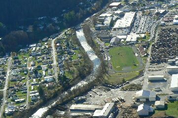
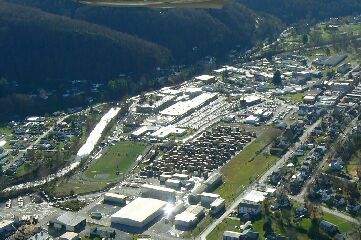
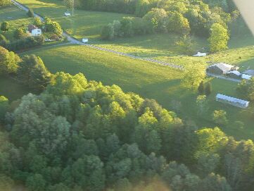
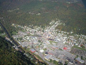
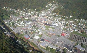
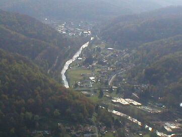
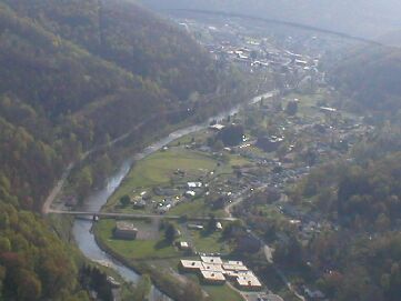
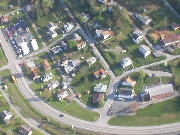
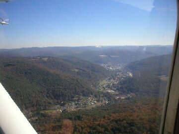
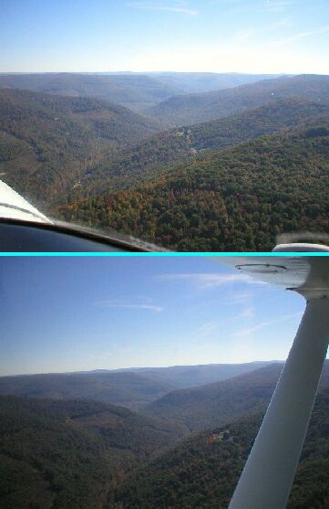
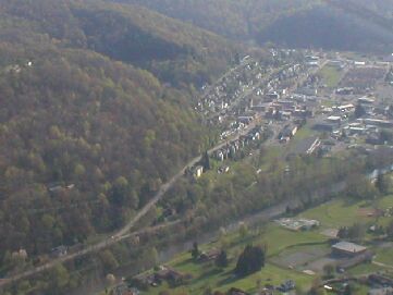
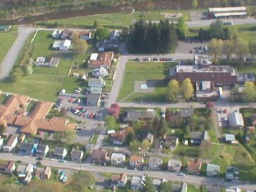
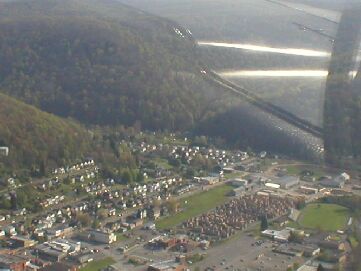
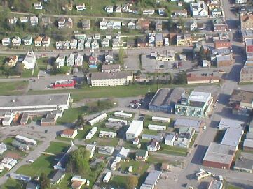
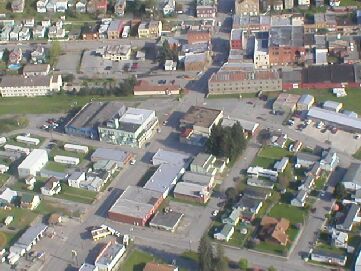
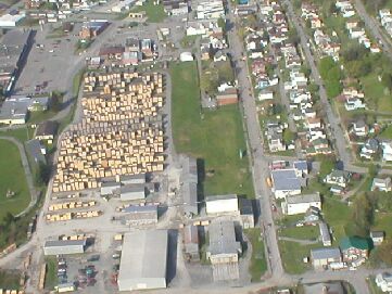
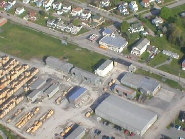
Richwood Aerial Photography, 2006 and 2009!

Richwood
Guestbook

Richwood 
Richwood The Air Photo gallery focusing on this West Virginia town just at the edge of the Monongahela National Forest.

Richwood Links


  (1)    ( Home ) Richwooders

  (2)    Aerial Photographys

  (3)    Nancy Hart

  (4)    Appalachian Miners

  (5)    Guestbook - Richwood

  (6)    Wanted

  (7)    4 Seasons, Richwood

  (8)    Picture Book (Photos)

  (9)    Postcards (Pic._ Book)

  (10)  Richwood, Flood 2003

  (11)  Richwood, Flood '54

  (12)  Richwood Blizzard '93

  (13)  Dain Grade School.

  (14)  Fenwick Grade School

  (15)  Little Laurel School

  (16)  Milltown Grade Sch.

  (17)  Richwood Grade Sch.

  (18)  South Side Grade Sch.

  (19)  Tannery Grade School

  (20)  Walnut St. Grade Sch.

  (21)  Pictorial Book

  ( 22)  Lodging

  ( 23)  Restaurants
        ( Richwood )

  (24)  Churches
         ( Richwood WV )

  (25)  Directions - Maps

  (26)  Attractions near by

  (27)  Search Richwooders

  (28)  Contact Richwooders

  (29)  Airport - Richwood

  (30)  Links ( to Other sites)

  (31)  Ramps


Ramp festivals

BILLYBOB MAGIC


Home

Back to Top


Home

Back to Top


Home

Back to Top


Home

Back to Top


Home

Back to Top


Home

Back to Top


Home

Back to Top


Home

Back to Top


Home

Back to Top


Home

Back to Top


Home

Back to Top


richwood wvrichwood w. va.
These are just a few of the pictures Mike Tyler took from his airplane.

Click on individual Aerial Photo for enlargement.
Game in process at ballfield!
Submitted by: Michael Tyler
Aerial Photo of Game in process at ballfield, 2009!
Low Altitude Air Photos of Looking toward the ballfield!
Submitted by: Michael Tyler
Aerial Photo of Looking toward the ballfield, 2009!
Low Altitude Air Photos of Richwood!
Submitted by: Mike Tyler
Aerial Photo of Ballfield 2008!


Low Altitude Air Photos of Horse Ridge!
Submitted by: Mike Tyler
Aerial Photo of Horse Ridge!

Low Altitude Air Photos of Richwood!
Submitted by: Mike Tyler
Aerial Photo of Richwood!

Low Altitude Air Photos of Richwood!
Submitted by: Mike Tyler
Great aerial view of Richwood population center!

Low Altitude Air Photos of Richwood!
Submitted by: Mike Tyler
Low Altitude Air Photo of Richwood!

Low Altitude Air Photos of Richwood!
Submitted by: Mike Tyler
Low Altitude Air Photo of Richwood WV.!

Low Altitude Air Photos of Richwood Areas!
Submitted by: Mike Tyler
Low Altitude Air Photo of Richwood Areas!

Low Altitude Air Photos of Richwood Areas!
Submitted by: Mike Tyler
Photography of Rt. 39/55 and Richwood!

Low Altitude Air Photos of Richwood Areas!
Submitted by: Mike Tyler
Aerial picture of Richwood Community Hospital!

Low Altitude Air Photos of Richwood Areas!
Submitted by: Mike Tyler
Aerial picture of Richwood East Side!

Low Altitude Air Photos of Richwood Areas!
Submitted by: Mike Tyler
Aerial picture of Richwood West Side!

Low Altitude Air Photos of Richwood Areas!
Submitted by: Mike Tyler
Here's a great aerial view of Richwood!

Low Altitude Air Photos of Richwood Areas!
Submitted by: Mike Tyler
Aerial Picture of Richwood!

Low Altitude Air Photos of Richwood Areas!
Submitted by: Mike Tyler
Aerial Photo of Richwood Lumber Yard!


Low Altitude Air Photos of Richwood Valley!
Submitted by: Mike Tyler
Richwood Valley Aerial Photo!

Low Altitude Air Photos of South Fork!
Submitted by: Mike Tyler
Logging at South Fork!

  • Bird eye view of Richwood taken in the early 1950's.


  • To submit a aerial picture or aerial pictures to our site, email your scanned image to:
    @richwooders.com


    Richwoodwww.richwooders.comW. Va.
    Aerial Photos


    [ www.richwooders.com ]The Air Photo Archives focusing on Richwood, West Virginia with Aerial Photos, Photographs, Aerial Imagery and Aerial Photography.