The skyline of New Orleans lies in the distance.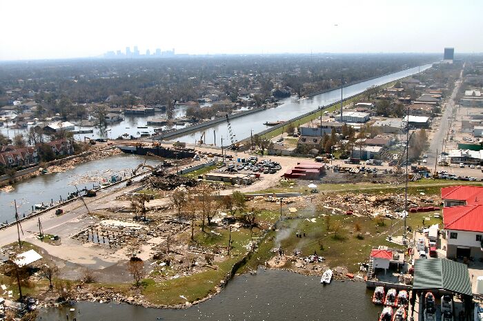 The 17th Street Canal stretches southward between Jefferson and Orleans Parishes in this aerial photo taken Sunday, September 4. The uncompleted bridge in the foreground enabled Corps of Engineers contracts to drive sheet piling to close off the canal from Lake Ponchartrain. Looking down the canal the breach into Orleans Parrish is visible. The skyline of New Orleans lies in the distance. (U.S. Army Corps of Engineers photo by Alan Dooley) The 17th Street Canal stretches southward between Jefferson and Orleans Parishes in this aerial photo taken Sunday, September 4. The uncompleted bridge in the foreground enabled Corps of Engineers contracts to drive sheet piling to close off the canal from Lake Ponchartrain. Looking down the canal the breach into Orleans Parrish is visible. The skyline of New Orleans lies in the distance. (U.S. Army Corps of Engineers photo by Alan Dooley) |